


Broadway Rec Center, Lauderdale County, Alabama
About
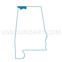
Outline

Summary
| Unique Area Identifier | 522220 |
| Name | Broadway Rec Center |
| County | Lauderdale County |
| State | Alabama |
| Area (square miles) | 1.28 |
| Land Area (square miles) | 1.28 |
| Water Area (square miles) | 0.00 |
| % of Land Area | 100.00 |
| % of Water Area | 0.00 |
| Latitude of the Internal Point | 34.81723510 |
| Longtitude of the Internal Point | -87.63614820 |
Maps


Graphs
Select a template below for downloading or customizing gragh for Broadway Rec Center, Lauderdale County, Alabama


Neighbors
Neighoring Voting District (by Name) Neighboring Voting District on the Map
- Central Baptist Church, Lauderdale County, AL
- East Campus Woodmont Baptist Church 10-12-1, Lauderdale County, AL
- Florance Blvd Church of Christ, Lauderdale County, AL
- Florence High School 10-12-2, Lauderdale County, AL
- Lauderdale Co Bd of Education, Lauderdale County, AL
Top 10 Neighboring County Subdivision (by Population) Neighboring County Subdivision on the Map
Top 10 Neighboring Place (by Population) Neighboring Place on the Map
Top 10 Neighboring Unified School District (by Population) Neighboring Unified School District on the Map
Top 10 Neighboring State Legislative District Lower Chamber (by Population) Neighboring State Legislative District Lower Chamber on the Map
Top 10 Neighboring State Legislative District Upper Chamber (by Population) Neighboring State Legislative District Upper Chamber on the Map
Top 10 Neighboring 111th Congressional District (by Population) Neighboring 111th Congressional District on the Map
Top 10 Neighboring Census Tract (by Population) Neighboring Census Tract on the Map
- Census Tract 109, Lauderdale County, AL (7,081)
- Census Tract 108, Lauderdale County, AL (3,797)
- Census Tract 107, Lauderdale County, AL (2,098)
- Census Tract 101, Lauderdale County, AL (1,959)